Boden is growing and now a detailed plan for new housing is out for the centrally located area of Tjärnbacken. The site has a land allocation agreement with plans for 150-200 apartments. The municipality is also planning initiatives such as a pedestrian and cycle path and a park area near Bodån (a creek)..
In the municipality’s comprehensive plan from 2020, Tjärnbacken has been marked as a proposed new residential area. Tjärnbacken is just a few minutes walk, about 700 meters, south of the center of Boden. It is bordered by Sveavägen to the south, Kyrkogårdsgatan to the west, Lundagårds cemetery to the north and Bodån to the east, in the area of Svea-Lunda.
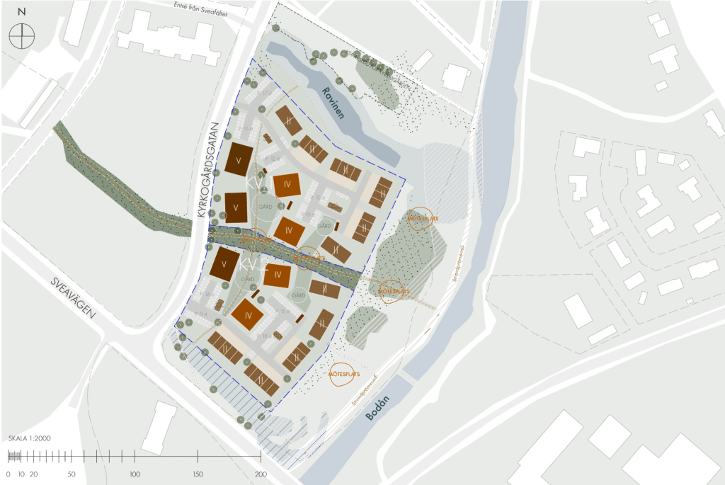
 Site plan showing the area’s plans and location. (Nordmark and Nordmark
The newly built Björkdungen preschool, walking paths and areas for spontaneous sports are located nearby. The land where Tjärnbacken is located was purchased by the municipality in 2016 and was previously used by the Swedish Armed Forces. At present, only two storage buildings and a training room remain on the site. The municipality uses the storage buildings and the area is otherwise unused. The detailed plan now out for consultation is consistent with the municipality’s master plan.
The consultation is an opportunity for the public to see the documents and make comments. These must be submitted in writing by March 4, 2024.
The documents are available at City Hall, City Library and on the municipality’s website and are available for consultation until March 4, 2024.
Land allocation for up to 200 apartments
There is already a land allocation agreement for Lindbäcks Bygg with the possibility of 150-200 apartments on Tjärnbacken, divided into terraced, semi-detached and apartment buildings.
The Boden municipality’s proposal also includes plans for a pedestrian and cycle path along the Bodån river. A new entrance and exit and an area set aside for parkland are proposed. The goal is to create a clear connection with attractive and natural entrances from Bodån, through the entire area, up to Kyrkogårdsgatan and Sveafältet, thus strengthening the cultural-historical connection to the surroundings. The new development is proposed as two blocks, each with its own access road from Kyrkogårdsgatan.
After the consultation, the comments received are compiled in a consultation report and, if necessary, the plan documents and plan map are revised. At the review, the next stage of the planning process, a final proposal will be presented and there will also be opportunities to submit comments at this stage.
Overview main image: Nordmark and Nordmark